Description
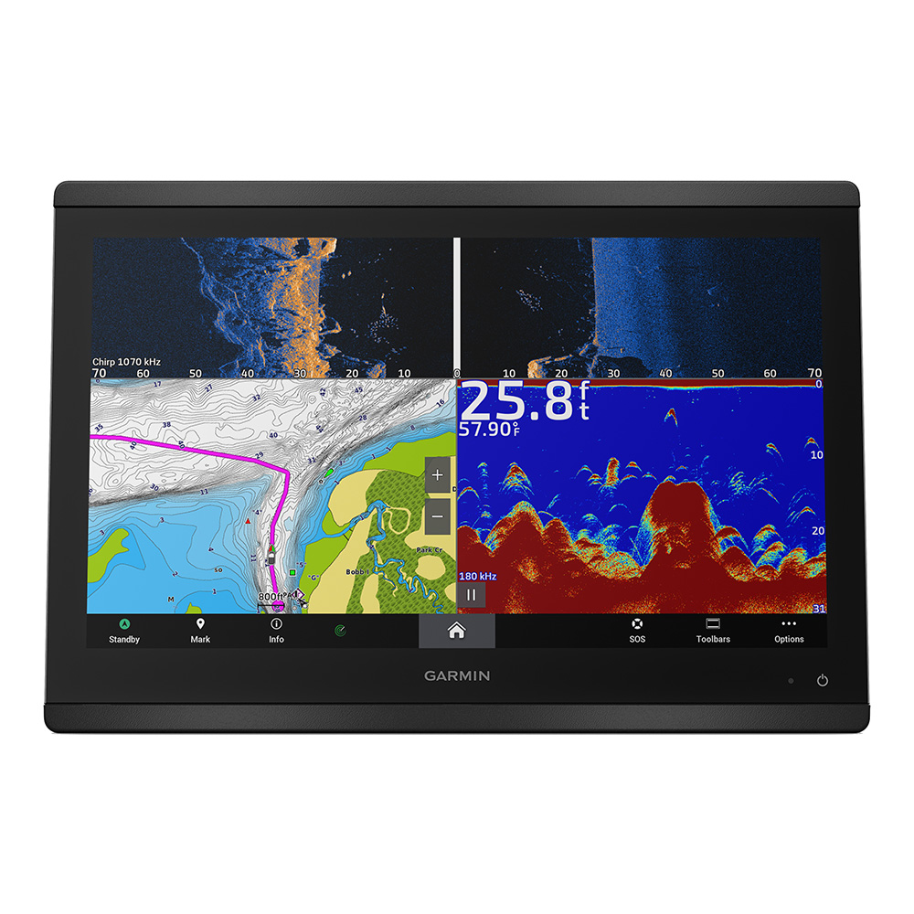
GPSMAP 8616xsv 16 pouces Traceur de cartes/sonar avec Garmin Navionics+.
SERIOUS ANGLERS, CRUISERS, SAILORS AND SAIL RACERS DEMAND SERIOUS EQUIPMENT
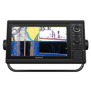
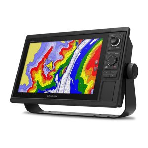
The easy-to-use, easy-to-install chartplotter/sonar combo delivers MFD performance in a combo-size package.
- Get wider viewing angles and superior clarity on the touchscreen with a full HD in-plane switching (IPS) display.
- Navigate confidently with built-in Garmin Navionics+™ inland and coastal mapping1.
- Easily build your marine system using the best of network connectivity.
- See below and around your boat with built-in sonar capabilities (transducers sold separately).
- From ANT® technology to Wi-Fi® networking, there are countless ways to connect to your system.
- With SmartMode™ station controls, everything is designed to give you quick, one-touch access to the information you need.
HD IPS Touchscreen
This display offers wider viewing angles, superior clarity and sunlight readability, even with polarized sunglasses.
Simple, Attractive Mounting Options
You can install multiple displays, either flat mounted edge-to-edge for a sleek glass helm look or mounted flush — creating a stunning helm.
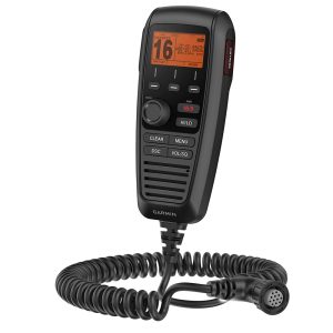
GRID™ 20 Remote Control
The optional, easy-to-use GRID 20 remote input device provides intuitive remote access and control of your entire Garmin marine system.
Traditional and Scanning Sonar Support
Get built-in support for 1-kW Dual-Channel CHIRP traditional sonar for superior target separation and ClearVü and SideVü scanning sonars to see up to 1,000’ below and around your boat at 260 kHz (requires transducer, sold separately).
Live Sonar Support
Pair your chartplotter with Garmin live sonar options (transducer sold separately) to see all around your boat in real time.
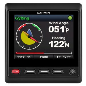
Garmin Sailassist™ Sailing Features
View laylines, race start line guidance, enhanced wind rose, heading and course-over-ground lines, true wind data fields and tide/current/time slider, wind angle, set and drift, wind speed, polars and more.
Preloaded Mapping
Experience unparalleled coverage and detail with built-in Garmin Navionics+™ integrated coastal and inland mapping that includes Auto Guidance+™ technology3 and a 1-year subscription for downloadable daily updates and more on select chartplotters.
Optional Charts and Maps
Bring a fresh new look and feel to your chartplotter with optional upgrade to Garmin Navionics Vision+™ premium chart subscription, featuring downloadable high-resolution relief shading, satellite imagery, sonar imagery and more.
Sailing Polars
Use the polar table to see key data, including how fast you should go at a certain wind angle and speed — so you know whether you need to adjust sail trim.
Garmin Marine Network
If you have multiple compatible Garmin devices on your boat, you can share information — such as maps, user data, radar and IP cameras — among them.
NMEA 2000® and NMEA 0183 Networks
Connect to autopilots, digital switching, weather, FUSION-Link™ audio system, media, VHF, AIS and more from one screen.
Activecaptain® APP
Built-in Wi-Fi® connectivity pairs with the free all-in-one mobile app for access to the all-in-one mobile app for access to the OneChart™ feature, smart notifications3 , software updates, Helm, Garmin Quickdraw™ Community data and more.
Integrated Bluetooth® and ANT Technologies
Connect with some of your favorite devices, such as quatix® marine watches, gWind™ Wireless 2 transducers, GNX™ Wind marine instruments and wireless remote controls.
Onehelm™ Feature
This feature brings together all the operations and capabilities of third-party devices, such as EmpirBus™ digital switching, on one screen.
Smartmode Station Controls
Get quick, one-touch access to the information you need to ease high-stress situations such as docking. You can incorporate networked sonar, radar, cameras, media and more.
Power-Pole® Shallow Water Anchor
By networking select Garmin chartplotters with a Force® trolling motor and your compatible Power-Pole shallow water anchoring system, you can access advanced boat control features6 from your plotter, including smart anchor auto-deployment, smart anchor jog, auto stow, anchor drag detection and auto guidance7 end-of-route anchoring. Spend more time fishing, less time positioning.
Send InReach® Device Messages
Pair your inReach satellite communicator5 to your chartplotter, and type custom messages using your MFD’s on-screen keyboard. Access your contact list or enter an email, inReach address or phone number. You can also group messages by conversation for a texting-like experience.
Dans la boîte :
- GPSMAP 8616xsv
- Câble d'alimentation
- NMEA 2000® drop cable
- NMEA 2000 T-connector
- Flush mount kit
- Sun cover
- Couvercles de garniture à pression
- Documentation
Connexions :
- Ports NMEA 2000® : 1
- Connections NMEA 0183 Input Ports: 1
- NMEA 0183 Input (TX) Ports: 1
- Video Input Ports: 1 (BNC composite); 1 HDMI (HDCP compliant)
- Ports de sortie vidéo : 1 HDMI
- Ports J1939 : 1
- Garmin Marine Network Ports: 2
- 8-Pin Transducer Port: Yes
- 12-Pin Transducer Port: Yes
- USB Ports: Yes
- Appairage Bluetooth® : Oui
- ANT+ (Connectivity): Yes
- Garmin Wi-Fi Network (local) Connection: Yes
1On select models
2Requires ActiveCaptain app on your compatible smartphone paired to a compatible GPSMAP chartplotter
3Auto Guidance+ ne sert qu'à des fins de planification et ne remplace pas les opérations de navigation en toute sécurité.
4When paired with a compatible smartphone
5Active satellite subscription required. Some jurisdictions regulate or prohibit the use of satellite communication devices. It is the responsibility of the user to know and follow all applicable laws in the jurisdictions where the device is intended to be used.
6Integration of these features requires purchase of a C-Monster GATEWAY through Power-Pole
7Auto guidance is for planning purposes only and does not replace safe navigation operations


Avis
Il n'y a pas encore d'avis.